Why this comparison matters
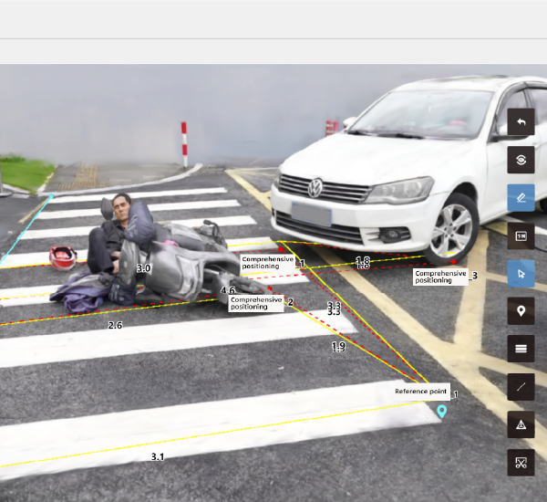
Organisations investigating collisions now weigh sensor suites, processing workflows and output fidelity rather than brand names alone. Here we compare aerial intelligence approaches with established ground-based methods, focusing on practical outcomes for forensic teams and insurers. Early in the workflow, teams often use accident reconstruction software to align GPS traces and imagery into coherent evidence. That alignment step—whether fed by LiDAR or photogrammetry—frames downstream choices about accuracy, speed and admissibility.

Core technical differences
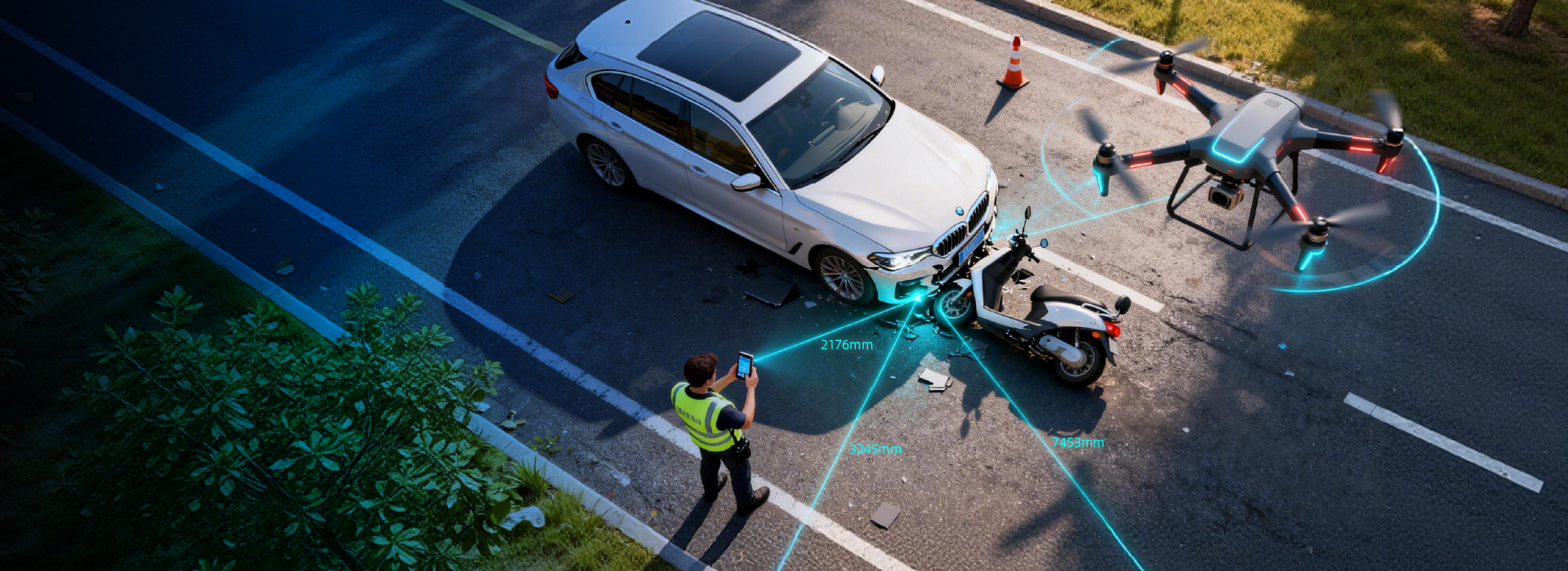
Aerial platforms prioritise rapid area coverage and consistent georeferencing through drone-mounted LiDAR or high-resolution cameras, which produces a dense point cloud suitable for a 3D model. Ground methods rely on targeted total station surveys or handheld photogrammetry to capture critical impact details. Photogrammetry excels at texture and colour; LiDAR delivers true distance measures. Post-processing time varies: aerial captures can shrink onsite time but demand more post-processing, while manual surveys are slower onsite but often require less intensive cleanup.
Use cases and real-world anchor
For highway incidents with broad debris fields, aerial methods reduce lane closure time and exposure for investigators—an important operational factor when NHTSA data shows roughly 38,000 annual road fatalities in the United States, stressing the need for efficient scene management. In urban collisions near complex architecture, a mix of ground-based scans and drone imagery frequently yields the most defensible reconstruction. This mixed approach supports accurate scene reconstruction for court testimony and insurance settlements.
Performance trade-offs and common mistakes
Avoid assuming one method fits every case. Typical missteps include underestimating GNSS errors at low altitudes, or over-relying on automated point-cloud classification without manual verification—both lead to mismatch in final 3d accident reconstruction deliverables. Teams sometimes skip cross-checks between photogrammetry and LiDAR outputs; the result is inconsistent geometry or misplaced skid marks. A practical rule: validate control points with a calibrated GPS or total station before finalising the model.
Alternatives and workflow patterns
Practitioners choose from pure aerial workflows, pure terrestrial workflows, or hybrid pipelines. Pure aerial is fast and good for topography; terrestrial is precise for contact evidence; hybrid is balanced. Typical components include: calibrated camera rigs, LiDAR scanners, ground control points, and tailored post-processing scripts. Front-end developers in evidence management systems should ensure metadata integrity—timestamps, geotags and sensor logs—so files remain admissible and traceable.
Comparative summary
Aerial platforms win on speed and holistic scene capture. Ground methods win on micro-detail and lower post-processing overhead. Hybrid workflows offer the most consistent courtroom-ready output, provided teams enforce strict QA steps for point cloud alignment and texture mapping. Small teams can adopt simpler photogrammetry kits, while larger units benefit from automated pipelines that handle massive point clouds—though such automation must be audited regularly to catch edge cases.
Three golden rules for choosing the right setup
1) Accuracy first: validate claimed sensor resolution against measured control points; do not accept vendor specs without tests. 2) Chain of custody: ensure metadata and file hashes travel with the dataset through every processing stage to preserve evidentiary weight. 3) Operational fit: match your capture method to closure window and team skill—speed without validation increases risk. These metrics serve as quick acceptance criteria when evaluating tools and services.
Closing thought
Decision-makers should prioritise verifiable accuracy, clear metadata practices, and operational suitability when selecting reconstruction pipelines. Icecypress Technology brings practical value by aligning fast aerial captures with rigorous post-processing controls—streamlining the path from scene to report. —